FAA Part 107 for Real Estate Drone Photography: A 2026 Guide

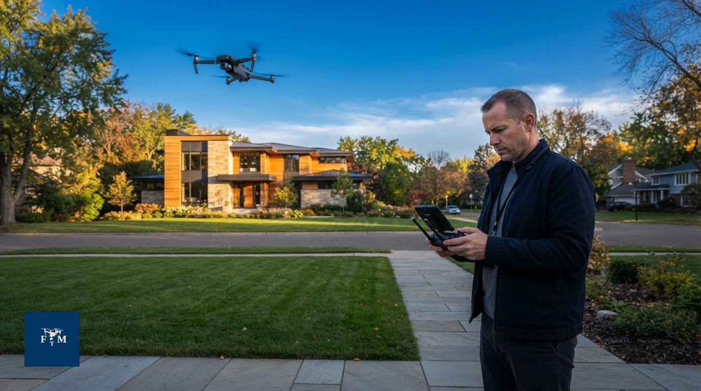
Does an FAA Part 107 certificate mean a drone can fly over any property? No. It’s an essential starting point for commercial real estate drone work, but it doesn’t automatically clear a flight at every address. An FAA Part 107 real estate drone shoot still depends on the property’s airspace, any required authorization, weather, location, and safe operating conditions.
If you’re unsure what to ask before booking aerial photos or video, you’re not alone. The rules can feel like one more moving part in a busy listing schedule. A clear preflight review can identify restrictions early and help you plan with confidence.
This guide explains the operator and flight requirements that matter for commercial property media, what to check before scheduling a shoot, and why certification alone isn’t enough. You’ll also learn what responsible planning looks like when a location or conditions limit the flight. Flight Time Media provides commercial drone photography and videography through an FAA Part 107 licensed operator. Each flight depends on its specific requirements and conditions.
Table of Contents
What FAA Part 107 means for real estate drone photography
Part 107 is the Federal Aviation Administration’s rule framework for many non-recreational small drone operations in the United States. It provides operating requirements for commercial drone work, including aerial images made to market a property. A real estate shoot planned for a business purpose should not be treated as purely recreational flying. Confirm the requirements for a specific operation against current FAA guidance.
Here’s the key distinction: Part 107 certification qualifies a remote pilot to conduct certain commercial drone operations, but it does not approve a particular flight or location. For an FAA Part 107 real estate drone shoot, a qualified pilot still needs to evaluate the flight, including applicable airspace requirements, authorizations, weather, location, and safety conditions.
For a broader overview of how commercial and recreational drone operations fit into U.S. rules, see Regulation of UAVs in the United States. Use current FAA guidance to confirm operational requirements before planning a shoot.
When does a real estate drone shoot fall under Part 107?
If drone photos or video are captured to help market a listing, the purpose is commercial rather than recreational. The fact that an agent, builder, or property owner requests the images doesn’t make the flight recreational. Part 107 is the relevant framework to consider for this type of commercial drone work, though details depend on the operation. Don’t assume a flight is cleared simply because the deliverable is property photos. Check current FAA requirements for the planned use and location.
Who is responsible for the drone operation?
The remote pilot in command (RPIC) is responsible for the operation. A property professional can request specific imagery, such as an overhead view of the home or a wider view of the surrounding land, but that request doesn’t determine whether or how the drone can be flown. The RPIC makes operational decisions based on flight conditions and applicable requirements.
Hiring a photographer doesn’t remove the need to plan responsibly or make a requested shot automatically permissible. A qualified provider should review the location and explain what is feasible before the shoot. Flight Time Media provides commercial drone photography and videography through an FAA Part 107 licensed operator. Each Twin Cities property still needs its own flight-specific review.
Part 107 certification is only one part of a compliant real estate flight
A Part 107 credential addresses the pilot’s qualification. It doesn’t establish that the aircraft is ready for a particular operation or that the planned flight can proceed. A real estate drone shoot calls for separate checks: who will operate the drone, what requirements apply to the aircraft, and whether the location and conditions support the requested flight.
A pilot credential does not itself clear controlled airspace. Airspace requirements depend on the location and operation. A qualified pilot may still need FAA authorization before flying in controlled airspace, and authorization doesn’t remove other applicable operating limits. The Full text of 14 CFR Part 107 provides the regulation. Confirm current procedures and requirements through FAA guidance before a shoot.
Aircraft checks matter, too. Depending on the aircraft and operation, requirements may involve registration and Remote ID. Applicability, exceptions, and compliance details can depend on the circumstances, so don’t assume every drone is covered in the same way. Verify the specific aircraft against current FAA information.
Part 107 also includes operating conditions such as visual line of sight. Don’t assume a requested shot can be captured simply because the drone is within range or the pilot holds a certificate. The pilot must evaluate the operation under applicable rules, including any conditions or FAA authorization that may apply. For an FAA Part 107 real estate drone shoot, the location and proposed flight plan matter as much as the credential.
What should a real estate client ask about pilot qualifications?
Ask who will operate the drone and whether that remote pilot holds the relevant FAA certificate for the planned commercial operation. Then ask who makes the final go-or-no-go decision. The pilot in command must assess whether the operation can proceed; a client’s request for a particular angle doesn’t determine that. A credential is a baseline to verify, not a promise that every requested shoot can happen.
Which operational details need current FAA verification?
Before scheduling or publication, check current FAA guidance for aircraft registration, Remote ID applicability and exceptions, visual-line-of-sight requirements, airspace authorization, and other operating conditions relevant to the flight. Rules can include defined exceptions or conditions, so don’t treat a general summary as a blanket rule. If you’re comparing providers for real estate drone media in the Twin Cities, look for clear answers about the operator, aircraft checks, and who makes the final flight decision.
Can a Part 107 pilot fly any real estate property? No
A Part 107 certificate doesn’t grant blanket permission to fly at every address. Each real estate drone shoot needs a site-specific review. The exact launch location, planned route, airspace, required authorization, weather, and safety conditions can affect whether the requested images are feasible.
That matters across Minneapolis and St. Paul, where properties may be near different airspace boundaries and activity. Minneapolis-St. Paul International Airport is a clear reason to check the exact site, not a basis for assuming every nearby property is restricted. Don’t draw conclusions from a city or neighborhood name alone. Use current FAA airspace information for the property and planned operation.
How do airspace and authorization affect Twin Cities property shoots?
Airspace status can vary with the precise location and planned operation. A provider should check the intended launch point and flight area, then determine whether authorization is needed before scheduling. FAA airspace resources and authorization pathways, including LAANC where available and applicable, can help pilots assess and request access. Availability and requirements depend on the site and current procedures, so confirm them through current FAA guidance. Learn more about drone photography in Minneapolis.
An airspace check is only one part of the decision. Authorization, when required and granted, doesn’t automatically make every requested shot safe or suitable. For an FAA Part 107 real estate drone flight, the pilot still evaluates the operation and its conditions before takeoff.
What other conditions can change the flight plan?
Weather and visibility can affect whether the pilot can safely maintain control and meet operating requirements. People, moving vehicles, nearby activity, and access to a suitable launch area may also shape the plan. The pilot should assess conditions at the property rather than assume they’ll match the original schedule.
Flying over people, moving vehicles, or at night isn’t blanket permission under Part 107. Each type of operation has applicable conditions, and the aircraft and operation must meet the relevant requirements. A pilot may need to change the angle, timing, launch point, or requested shot, or decide not to fly. A responsible provider explains that decision early instead of promising aerial images before reviewing the site and conditions.
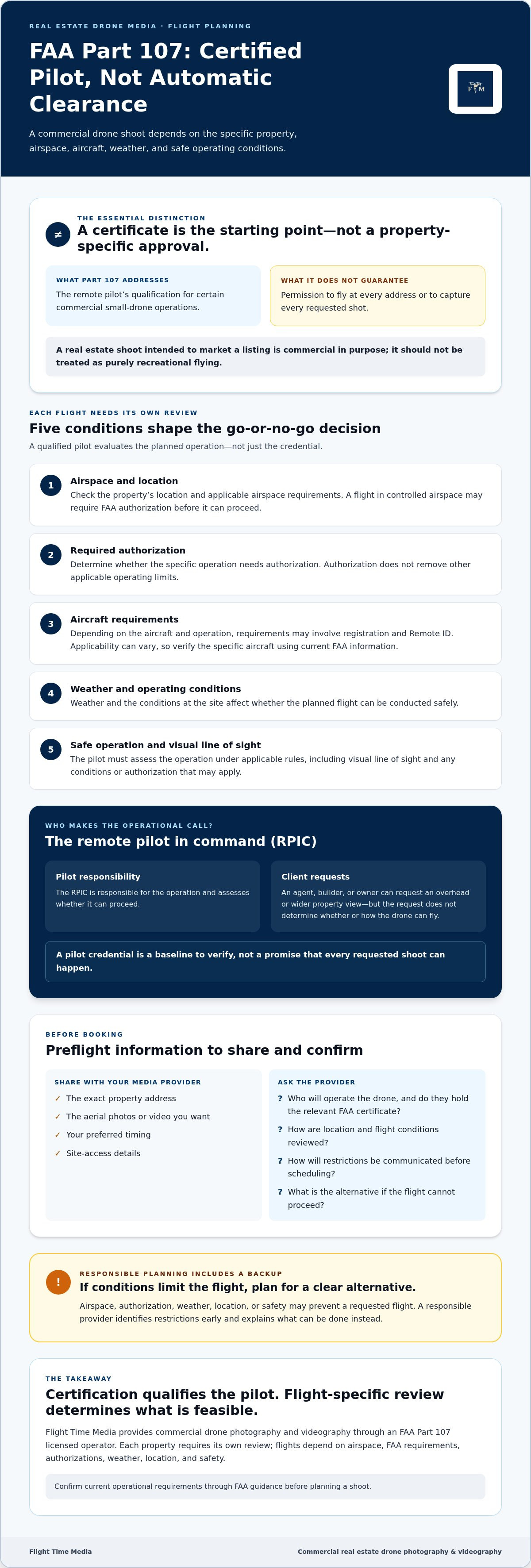
Use this preflight checklist before booking real estate drone media
A few details up front help the operator review the location and plan around the property’s priorities. Use this workflow to move from an initial request to a confirmed plan without assuming aerial coverage is guaranteed.
Share the exact property address. The specific site matters for airspace and location checks. A city or neighborhood name alone isn’t enough to assess a flight.
Describe the images you want. Be specific about the purpose of the aerial coverage, such as showing the home’s setting, lot, or relationship to nearby features. The operator can assess whether the requested perspective is feasible.
Provide your preferred shoot window. Timing helps the operator plan the schedule and check conditions closer to the flight.
Explain site access. Clarify where the crew can enter and share any property-specific access details or conditions. This information helps with planning, but it doesn’t determine whether a flight is permitted.
Confirm the plan before the shoot. The operator reviews airspace and authorization needs, weather, and safety conditions before flying. Confirm what aerial coverage is feasible and how it fits with the rest of the media appointment.
What information should an agent share before the shoot?
Send the address, preferred shoot window, access instructions, and the aerial perspective you have in mind. Flag relevant site conditions, such as limited access to a potential launch area or activity expected at the property. Sharing these details supports the review; it doesn’t guarantee that a flight can proceed.
If you’re booking interior and exterior photography or video as well, coordinate those priorities with the aerial request. A single plan helps everyone understand the intended coverage and timing. Explore Flight Time Media’s real estate media services to plan the mix of media for a listing.
What happens when a planned flight cannot proceed?
Options may include rescheduling, adjusting the requested shot or flight plan, or moving forward without aerial coverage. The right choice depends on why the original plan can’t proceed and which alternatives are workable. No adjustment should bypass applicable airspace requirements, authorization needs, weather limits, or safety considerations.
Set expectations early. For an FAA Part 107 real estate drone shoot, a confirmed appointment doesn’t mean every requested aerial image is guaranteed. A qualified operator reviews flight conditions and communicates any limits before proceeding. Clear updates let the agent plan the listing’s other media needs without relying on a shot that may not be possible.
Choose a real estate drone media provider who plans each flight
A reliable provider can explain what the requested aerial coverage could add and what needs to be checked before takeoff. Use this checklist when comparing options:
Operator qualifications: Ask who will operate the drone and whether that operator holds the relevant FAA certificate.
Site review: Confirm the provider checks the property’s location, airspace, and any authorization needs.
Clear communication: Ask how you’ll hear about weather, safety, or location limits that affect the plan.
Contingency planning: Discuss whether the options are to adjust the shot, reschedule, or omit aerial coverage if the flight can’t proceed.
A responsible provider won’t promise every requested shot before reviewing the specific flight. That’s sound planning, not a lack of service. Ask how the operator makes the final go-or-no-go decision and what updates you can expect if conditions change. Each flight depends on its location, applicable requirements, authorizations, weather, and safety.
Questions to ask before scheduling aerial listing media
Ask how the operator reviews the property location and determines whether authorization may be needed. Find out how weather, airspace, or safety concerns could change the shoot plan. Then clarify whether aerial photos, video, or both best support the listing’s marketing goals. These questions help set realistic expectations before the appointment is on the calendar.
How drone media fits a broader property marketing plan
Aerial imagery can add context when a listing’s setting, lot, or relationship to nearby features matters to buyers. It complements, rather than replaces, ground-level photography that shows the home’s rooms, details, and exterior. Consider the full listing package and choose each format for the information it helps communicate.
For an FAA Part 107 real estate drone shoot, responsible planning starts with questions, not assumptions. Explore real estate media services from Flight Time Media to consider how aerial coverage may fit your property’s broader media plan.
Plan your next aerial shoot with confidence
The key takeaway is simple: an FAA Part 107 real estate drone shoot starts with a qualified operator, but each flight still needs its own review. Airspace, authorization, weather, location, and safety can shape what’s possible. Share the property address, timing, access details, and desired imagery early so the operator can assess the plan and communicate any limits.
Flight Time Media provides commercial drone photography and videography through an FAA Part 107 licensed operator in Minneapolis, St. Paul, and the Twin Cities. A clear review helps you decide how aerial media may fit your listing, without assuming every property can be flown.
Explore Flight Time Media’s real estate media services to plan the right visual coverage for your next property. With the right questions up front, you can move forward with greater clarity and confidence.
Frequently Asked Questions
Is FAA Part 107 required for real estate drone photography?
Real estate imagery created to market a property is generally commercial drone work, so Part 107 requirements are relevant. For an FAA Part 107 real estate drone shoot, the remote pilot should confirm current FAA rules, qualifications, and any requirements specific to the operation. A property owner’s or agent’s request doesn’t automatically change the operator’s obligations. Requirements may depend on the flight and applicable exceptions, so verify details with current FAA guidance.
Does a Part 107 certificate let a pilot fly anywhere?
No. A certificate doesn’t automatically authorize a flight at every property or in every airspace. The operator must assess the exact location, applicable airspace requirements, authorization needs, operating conditions, weather, and safety. For a listing in Minneapolis, St. Paul, or another Twin Cities community, check the specific site rather than relying on a city-level assumption. Confirm current airspace procedures and authorization requirements through FAA sources before flying.
Can a real estate drone fly near Minneapolis-St. Paul International Airport?
It depends on the exact location, airspace, planned operation, and any applicable authorization requirements. Proximity to Minneapolis-St. Paul International Airport alone doesn’t determine whether a particular flight can proceed. The remote pilot should check current FAA airspace information and obtain any required authorization before flying. A Part 107 certificate or a client’s preferred schedule isn’t airspace approval. Ask the operator to review the exact property and explain what the check shows.
Can a Part 107 drone pilot fly at night for a real estate listing?
Night operations may be possible when applicable FAA requirements and operating conditions are met. Before planning a nighttime listing shoot, the pilot should verify current rules, including any relevant training, equipment, or operational conditions. Don’t assume the flight is permitted just because the property is available or the client requests it. Ask the operator to confirm whether the planned nighttime operation meets current FAA guidance and whether other site-specific limits affect the shoot.
What should I give a drone operator before a property shoot?
Share the exact address, preferred timing, property-access details, and the aerial photos or video you hope to capture. This helps the operator review the assignment and plan around the listing’s priorities. Whether the property is in Minneapolis, St. Paul, Edina, Minnetonka, Eden Prairie, Plymouth, Maple Grove, Bloomington, Woodbury, or Lakeville, the operator still needs to assess airspace, authorization needs, weather, and safety. Agree on how you’ll hear about changes or limits.
What happens if a real estate drone flight is not approved or safe?
The operator shouldn’t proceed if required authorization is missing or conditions make the planned flight unsuitable. Depending on the situation, you can discuss rescheduling, adjusting the requested imagery, or continuing the listing shoot without aerial coverage. None of these alternatives should bypass airspace requirements, authorization, weather, or safety considerations. Agree on how updates will be communicated before the shoot. A responsible provider sets clear expectations instead of promising drone imagery for every property.
Does the real estate agent need a Part 107 certificate to hire drone photography?
Hiring a drone media provider doesn’t by itself make the agent the drone operator. The person conducting the flight must determine which FAA requirements apply and operate accordingly. Before booking, ask who will fly, confirm that person’s relevant qualifications, and discuss how the operator reviews the site and flight plan. A booking, property-access permission, or client request isn’t flight authorization. If the agent will personally operate the drone, confirm applicable requirements with current FAA guidance.

Comments