Aerial Imaging for Property Listings: Complete Guide

Updated: Sep 9
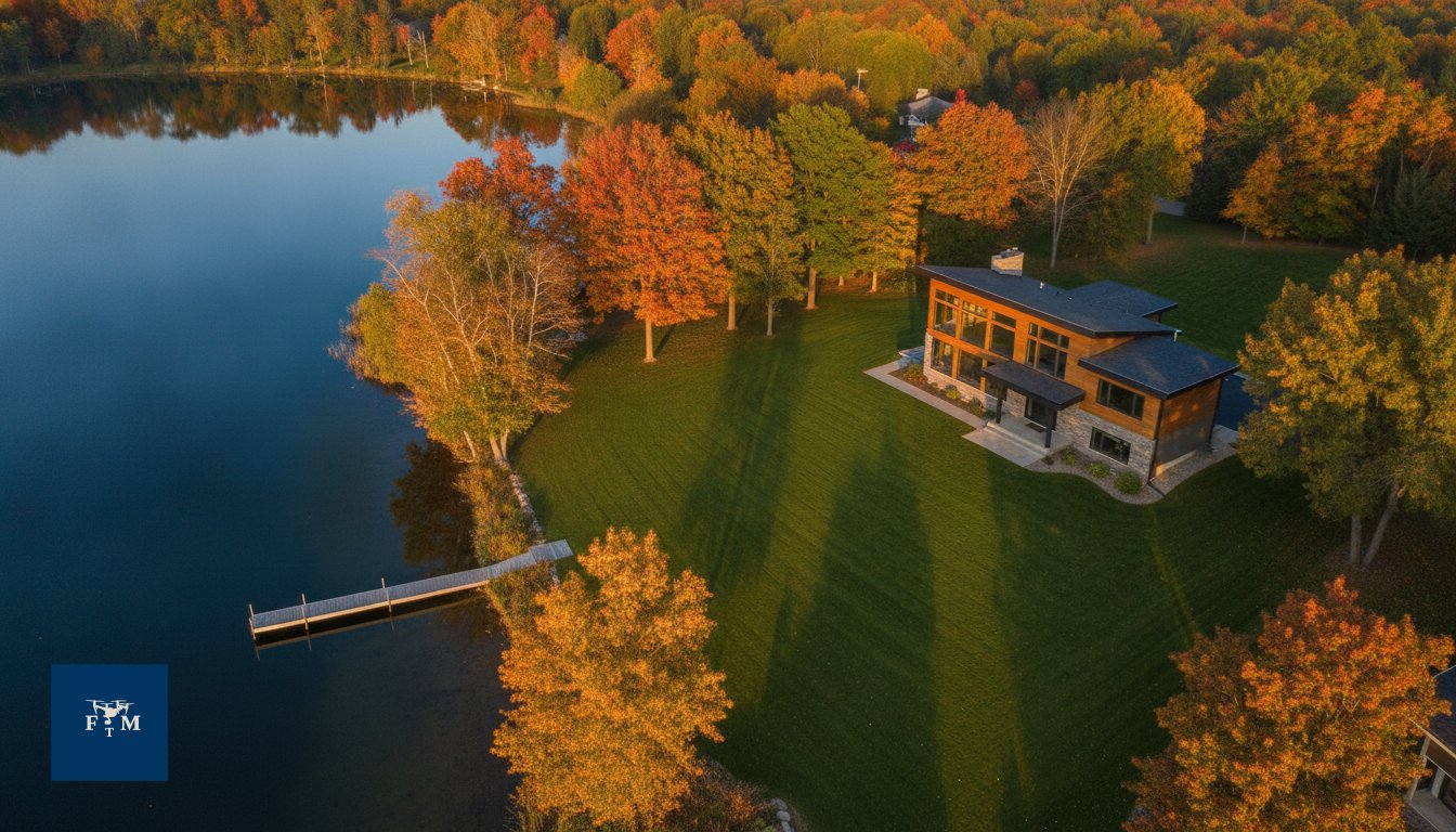
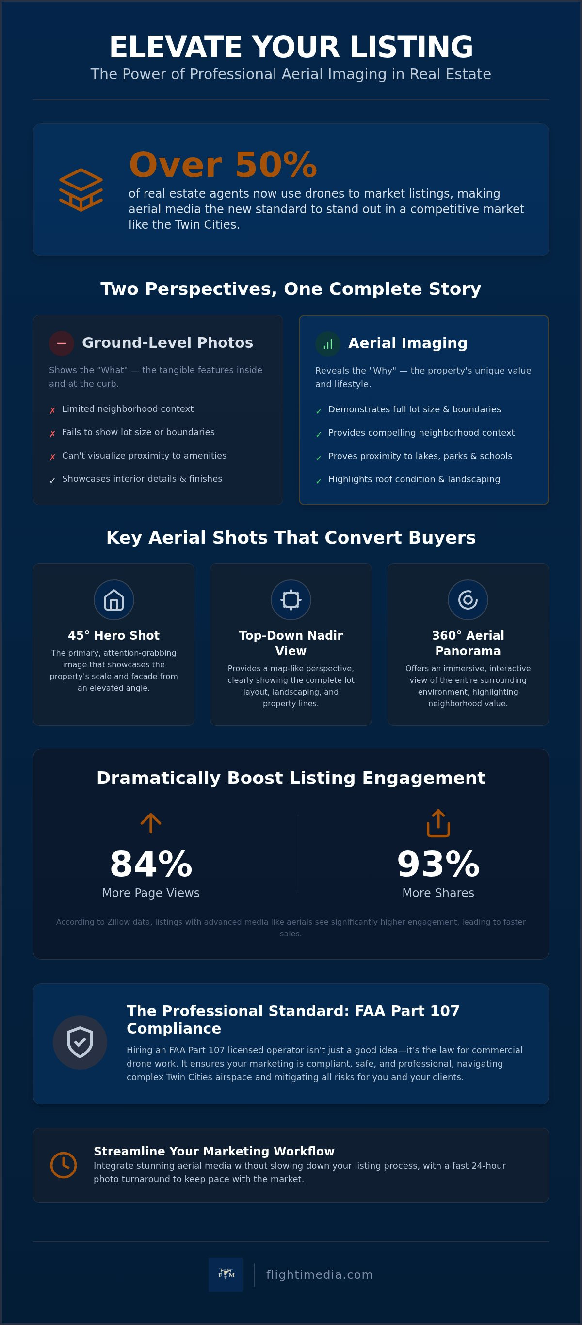
Did you know that over 50% of real estate agents now use drones to market their listings, a massive jump from just a year ago? It's no longer just a luxury for high-end mansions; it's a standard requirement for any listing that needs to stand out in a competitive Twin Cities market. When you use professional aerial imaging for property listings, you provide the context that ground-level shots simply can't reach. You aren't just selling a house; you're selling the five-minute walk to the lake in Edina or the vast acreage of a property in Lakeville.
We understand the frustration of watching a great listing sit on the market because buyers can't visualize the neighborhood or the lot size. You want a streamlined way to showcase every angle without worrying about complex FAA regulations or safety risks. This guide will show you how to leverage aerial media to capture high-intent buyers and boost your engagement on Zillow and the MLS. We'll walk through the logistical essentials of working with FAA Part 107 licensed operators, navigating local airspace, and choosing the right media package to make your next listing impossible to ignore.
Table of Contents
What is Aerial Imaging for Property Listings?
Professional aerial imaging for property listings is the process of capturing high-resolution photos and cinematic video from elevated perspectives using drone technology. It bridges the visual gap that traditional ground-level photography leaves behind. While a standard camera can show the condition of a kitchen or the size of a living room, it can't show a buyer how the backyard connects to a local trail system or the exact layout of a sprawling lot. This media provides a comprehensive view of both the structure and its surrounding environment.
The industry has seen a massive shift in how these tools are used. Just a few years ago, bird's-eye views were reserved for high-end luxury estates. Today, they're a baseline expectation for buyers browsing the MLS. Aerial imaging for property listings transforms a static set of photos into a cohesive story. It's about providing context. If a property is located near a desirable school in Edina or a park in Minnetonka, ground-level shots fail to prove that proximity. Professional aerial media makes those connections undeniable.
The Evolution of Real Estate Perspectives
Before drones became accessible, getting an aerial view required hiring a helicopter and a specialized crew. It was expensive, loud, and logistically difficult. Modern drone technology has democratized this perspective, making it accessible for every listing from starter homes to commercial developments. This evolution satisfies the "curiosity gap" for online buyers. They don't just want to see the house; they want to see the street, the neighbors, and the roof's condition. By showing the property within its natural environment, you answer these questions before the first showing even happens. It creates a sense of place that ground-level photography simply can't replicate.
Key Components of an Aerial Media Package
A professional aerial media strategy isn't just about taking one or two high shots. It involves a specific set of deliverables designed for different marketing platforms. You can explore how these fit into a broader plan on our services page. A standard package usually includes several key assets:
High-resolution still photography: These are the "hero shots" that grab attention in search results and look crisp in high-end print brochures.
4K cinematic video: This adds a layer of motion that is perfect for social media and agent reels, helping a listing stand out in a crowded feed.
360-degree aerial panoramas: These offer an immersive experience, allowing buyers to virtually spin around and see the entire neighborhood context from above.
The Marketing Impact: Why Aerial Perspectives Convert Buyers
The first image a buyer sees on Zillow or the MLS often determines whether they click through or keep scrolling. This "hero shot" carries immense psychological weight. When you utilize aerial imaging for property listings, you aren't just showing a house; you're presenting a lifestyle and a sense of security. Elevated shots allow buyers to immediately understand the property's scale and its relationship to the street, which builds trust before they even step foot on the driveway.
Showcasing Neighborhood and Location Context
Modern buyers look for more than just square footage. They want to know if the home is truly walkable to the park or how close the neighbors really are. We often talk about a home's "Walk Score," but professional media provides the "Visual Score." It proves proximity to amenities like the Chain of Lakes in Minneapolis or top-rated schools in Woodbury. Instead of asking a buyer to take your word for it in the description, you show them the commute and the surrounding mature tree lines in a single frame.
For rural estates or large suburban lots in the St. Paul metro, ground photos often struggle to define where the property ends. Aerial perspectives clearly demonstrate lot size and boundaries. This is especially vital for properties with "invisible" value, such as a recently replaced roof, solar panel installations, or complex landscaping layouts that aren't apparent from the curb.
Improving Listing Engagement and ROI
Data consistently shows that high-end visuals drive results. According to Zillow data from 2026, listings featuring advanced media like interactive tours and aerial views received 84% more page views and 93% more shares than those without. This isn't just about looking premium; it's about velocity. High-quality media helps properties go pending faster by capturing high-intent buyers early in their search. You can find more NAR guidance on drones in real estate regarding how these tools impact marketing efficiency and legal standards.
Investing in these visuals also serves a dual purpose for the agent. It positions you as a tech-forward professional who goes above and beyond for their clients. When you present a comprehensive media package during a listing presentation, you're offering a level of service that justifies your commission and helps you win more business in a competitive market. It turns a standard listing into an immersive neighborhood story that keeps buyers on the page longer.
Navigating Drone Regulations and Safety in the Twin Cities
While the visual impact of aerial imaging for property listings is undeniable, the logistical side requires strict adherence to federal and local laws. Operating a drone for commercial purposes isn't the same as flying one for a hobby. In the Twin Cities, where air traffic is dense and neighborhoods are closely packed, safety and compliance are the foundation of any successful shoot. Every flight we conduct is performed by an FAA Part 107 licensed operator, ensuring that your marketing remains legal and your liability is minimized.
Why FAA Part 107 Compliance Matters
The FAA requires a Remote Pilot Certificate for anyone using a drone to help sell a property. Hiring an unlicensed "hobbyist" pilot or attempting to fly a personal drone for a listing puts both the agent and the brokerage at risk for significant federal fines. Professional compliance goes beyond just having a license. It includes carrying specific liability insurance that covers aerial operations, which most standard business policies exclude. When you work with a trained professional, you're paying for the peace of mind that comes with expert risk management and technical mastery of the aircraft.
Local Twin Cities Airspace Constraints
The Minneapolis-St. Paul International Airport (MSP) creates a massive footprint of controlled airspace that covers large portions of the metro area. Flying a drone in Bloomington, Eagan, or parts of South Minneapolis often requires specific LAANC (Low Altitude Authorization and Notification Capability) approval. A professional pilot knows how to navigate these digital grid systems to get instant or manual authorization from the FAA. Operations always depend on airspace, current FAA rules, and local safety conditions. For example, a listing in a densely populated area like Edina requires a different flight plan and safety protocol than a rural property in Lakeville to ensure neighbor privacy and ground safety.
Minnesota weather adds another layer of complexity. High winds, freezing rain, and heavy snow can all ground a flight. A professional pilot monitors METAR reports and wind gusts to make a final safety call. We prioritize the safety of the property and the public above all else. If conditions aren't right, we reschedule to ensure the final aerial imaging for property listings meets our quality standards without risking a crash or equipment failure. This methodical approach ensures that the "friction-free" experience we promise remains consistent, regardless of the logistical hurdles a specific location might present.
Key Aerial Shots Every Listing Needs to Stand Out
A successful strategy for aerial imaging for property listings depends on a specific shot list that answers buyer questions before they're even asked. We don't just fly around the property; we capture specific angles that highlight the home's best features and its geographical value. This methodical approach ensures every image serves a purpose in your marketing funnel and provides the context buyers crave.
The "Hero Shot" is your most critical asset. By capturing the front elevation from a 45-degree angle at a moderate height, we show the depth of the home and its curb appeal simultaneously. This shot is often the one that stops the scroll on Zillow. Next is the "Top-Down" or Nadir view. This perspective is essential for showcasing lot layout, pool placement, and landscaping. It provides a clear, map-like understanding of the property boundaries that ground photos can't touch. Finally, a high-altitude "Neighborhood Context" shot places the home within its community, showing proximity to local landmarks like Lake Minnetonka or the St. Paul skyline.
Planning the Perfect Aerial Session
Timing determines the quality of your lighting. While "Golden Hour" provides a warm, premium glow, high noon is often better for minimizing shadows on heavily wooded lots. In Minnesota, seasonality plays a huge role in your marketing strategy. Capturing a home during a lush Woodbury summer looks very different than a crisp, snow-covered winter scene in Plymouth. Regardless of the season, exterior prep is vital. Always ensure cars are moved from the driveway, trash cans are hidden, and construction debris is cleared before the pilot arrives. This ensures a polished result without the need for expensive post-production cleanup.
Advanced Aerial Media: Beyond Still Photos
Static images are just the beginning. To truly dominate a local market, you need motion. We specialize in creating real estate agent reels that use cinematic "Orbit" and "Fly-Through" shots to create high-energy social media content. We also use digital overlays to label property lines and nearby points of interest, removing any ambiguity for the buyer. These perspectives can be seamlessly integrated into Zillow 3D Home Tours, providing a complete 360-degree understanding of the property from the ground to the sky.
Ready to elevate your next listing? You can book your first real estate photography shoot for FREE, which includes professional drone photos and a 2D floor plan with a fast 24-hour turnaround.
Streamlining Your Marketing with Professional Aerial Media
Integrating aerial imaging for property listings into your standard workflow shouldn't add complexity to your schedule. A successful marketing strategy uses these high-altitude perspectives to anchor a broader visual story. By combining drone media with professional photography, you create a multi-dimensional experience that keeps buyers engaged. This integrated approach ensures that every platform, from the MLS to social media reels, presents a consistent and premium brand image for both the property and the listing agent.
Speed is the most valuable currency in the Twin Cities real estate market. A listing that lingers without high-quality visuals loses its initial momentum. We prioritize a 24-hour photo turnaround because we know that professional media is only useful if it's delivered in time for your go-live date. This efficiency allows you to move from the shoot to the active listing phase without missing the crucial first weekend of buyer interest. Our methodical delivery process removes the friction typically associated with high-end media production.
Maximizing visibility also means leveraging premium platforms like Zillow Showcase. While we don't claim to be an official Zillow partner, we provide the high-resolution media and interactive assets required to power these enhanced listings. You can find more information on these features at the official Zillow Showcase resource. By providing the interactive floor plans and aerial context these platforms require, we help you secure the priority placement and increased engagement needed to capture high-intent buyers early in their search.
The Flight Time Media Advantage
Our team operates with a focus on professional confidence and streamlined execution. We understand the specific nuances of the Twin Cities metro, from the lakefront requirements in Minnetonka to the suburban estates of Woodbury. We function as a tech-forward ally that handles the logistics of FAA Part 107 compliance and airspace authorizations so you don't have to. This reliability simplifies your workflow, allowing you to focus on client relationships while we handle the technical execution of your visual marketing with precision and punctuality.
Get Started: Your First Shoot is Free
We're committed to proving the value of our streamlined process through direct results. To help you experience the impact of professional media firsthand, we offer your first real estate photography shoot for FREE. This isn't a stripped-down trial; it includes professional drone photos, a 2D floor plan with accurate measurements, and our standard 24-hour turnaround. It's a risk-free way to elevate your next listing today and see exactly how professional aerial imaging for property listings transforms buyer interest and market performance.
Elevate Your Next Listing with Precision Media
Professional aerial imaging for property listings is more than a visual upgrade; it's a strategic marketing tool that builds buyer confidence and tells a complete neighborhood story. By showcasing the full environment and providing clear context, you remove the guesswork for potential buyers and capture high-intent interest early. Remember that safety and speed are the pillars of a successful media strategy. Working with an FAA Part 107 licensed operator ensures your listings remain compliant while our 24-hour turnaround keeps your marketing schedule on track across the entire Twin Cities metro.
It's time to move beyond static ground-level photos and give your clients the high-end perspective they expect. We've streamlined the entire process so you can focus on closing deals while we handle the technical execution. Don't let your next property blend into the crowd when you can highlight its true potential from the sky. We're here to be the dependable backbone of your marketing efforts, providing polished results that help you win more listings.
Ready to transform your property presentations? Book Your First Shoot FREE (Includes Drone Photos!) to receive high-end photography, drone shots, and a 2D floor plan at no cost. Let's make your next listing impossible to ignore.
Frequently Asked Questions
Do I really need an FAA licensed pilot for real estate drone shots?
Yes, the FAA requires a Remote Pilot Certificate under Part 107 for any commercial drone operation. This includes real estate marketing for agents and builders. Hiring an unlicensed pilot can lead to federal fines for both the agent and the brokerage. Our pilots are fully licensed and trained to manage the risks of flying in urban areas like Bloomington or Edina. This ensures your marketing remains legal and your professional reputation stays protected.
How much does aerial imaging for property listings cost in Minneapolis?
We don't provide a one-size-fits-all price because every property has different needs, but we offer a significant incentive for new clients. Your first real estate photography shoot is free, and this includes professional drone photos and a 2D floor plan. This allows you to experience the quality of our aerial imaging for property listings without an initial investment. We serve the entire metro from Lakeville to Maple Grove with transparent, results-oriented service.
Can you fly a drone in any neighborhood in the Twin Cities?
No, drone operations depend on airspace restrictions, weather, and safety protocols. Large portions of the Twin Cities fall under controlled airspace due to the Minneapolis-St. Paul International Airport. While we use LAANC to get instant authorization in many restricted areas, some locations have strict no-fly designations. We always check the specific coordinates for your listing in Woodbury or Minnetonka before confirming the shoot to ensure federal compliance and safety.
What happens if the weather is bad on the day of the shoot?
We prioritize safety and quality, so we reschedule flights if weather conditions are unfavorable. High winds, heavy rain, or snow can damage equipment and produce poor visual results. Our pilots monitor local weather reports in the St. Paul metro carefully. If we can't fly safely on the scheduled day, we work with you to find the next available window. This ensures your listing still gets the premium views it needs without unnecessary risk.
How long does it take to get the aerial photos back?
You'll receive your edited photos within 24 hours of the shoot. We understand that listing velocity is critical in a competitive market like Eden Prairie or Plymouth. Our streamlined editing process ensures that you don't have to wait days to get your listing live on the MLS. This fast turnaround applies to all our standard photography packages, including those that feature professional aerial imaging for property listings, helping you maintain momentum.
Do aerial shots help with Zillow ranking?
High-quality visuals significantly increase engagement, which can positively impact how your listing performs on Zillow. While we aren't an official Zillow partner, our media supports Zillow Showcase and 3D Home Tours. Zillow data from 2026 suggests that listings with advanced media receive more page views and saves. Providing a bird's-eye view makes your listing more interactive. This keeps potential buyers on your page for longer periods, signaling higher interest to the platform.
Should I get aerial video or just still photos for my listing?
We recommend using both to maximize your reach across different platforms. Aerial stills are essential for the MLS and print brochures because they capture the hero perspective of the home. Aerial video is perfect for agent reels and social media platforms like Instagram or TikTok. Motion creates a cinematic feel that helps your listing stand out in a crowded feed. It's an effective way to capture attention, especially for luxury estates in Minnetonka.
Is aerial imaging worth it for smaller properties or condos?
Yes, aerial media is highly effective for smaller homes and condos because it highlights the surrounding lifestyle. For a condo in downtown Minneapolis, an aerial shot proves proximity to the river or local dining. For a smaller home in a dense neighborhood, it shows the backyard's privacy or the short walk to a nearby park. It's about selling the location and the neighborhood context. You're proving value that ground-level photos simply cannot reach.


Comments